

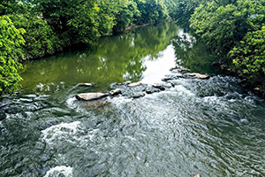
Brandywine Creek
The Brandywine Creek is made up of the East Branch, West Branch, and the Main Stem of the Brandywine for a total of 60 water miles. The headwaters in both the East and West Branches have been designated as “High Quality” and are annually stocked with trout for recreational fishing, yet the overall watershed faces development pressures associated with the expanding footprint of the Philadelphia region. Runoff pollution, flooding, and erosion have earned many areas of the Brandywine the designation of “impaired.” The loss of riparian buffer cover due to land development presents the greatest challenge to the quality and health of the Brandywine Creek system. Keeping the water swimmable and fishable is a constantly challenging reality, about which landowners and farmers need constant education and support. Guardians of the Brandywine’s educational and volunteer restoration projects are all working to protect and improve the water’s quality.

Buffalo Creek
Buffalo Creek is a 34-mile tributary of the Allegheny River that drains into eastern Butler, western Armstrong, and a very small portion of northern Allegheny Counties in western Pennsylvania. An Audubon-designated Important Bird Area and high-quality watershed, Buffalo Creek is an area of high biological diversity and home to many species of conservation concern. This scenic river is important ecologically, recreationally, economically, and culturally. The watershed is popular for recreational activities such as fishing, paddling, and hiking. Conservation challenges include development, forest fragmentation, stormwater impacts, Marcellus Shale gas extraction, erosion, sedimentation, nutrients, invasive species, acid mine drainage, and the Wooly Hemlock Adelgid. The Audubon Society of Western Pennsylvania works to restore the watershed, activities include riparian buffer restoration, permitting and planning for the Buffalo Creek Nature Center along Little Buffalo Creek, environmental education in the Freeport Area School District, and public education.
Connoquenessing Creek
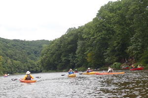
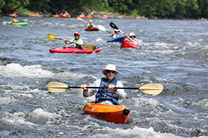
Connoquenessing Creek is an important waterway in Western Pennsylvania, flowing 54 miles through Butler, Beaver, and Lawrence Counties and providing many recreational activities for the community such as fishing, swimming, kayaking, canoeing, paddleboarding, inner tubing, hiking, camping, wildlife watching, and relaxing. The waterway is very diverse, and the lower section contains several miles of whitewater rapids. At one time the creek provided clean drinking water to several communities; however, due to decades of abuse and neglect the water is no longer safe to drink. Tragically, Connoquenessing Creek has become an endangered natural resource. The creek was rated the second most polluted waterway in America in 2000 due to detrimentally high nitrate levels from industrial discharge. Waste continues to be directly dumped into the creek by illegal dumping and annual flooding. Allegheny Aquatic Alliance has focused on this waterway due to its deplorable conditions. Since 2012, they have developed several different programs and projects to restore and protect Connoquenessing Creek.

Lackawanna River
The Lackawanna River flows for 60 miles through Susquehanna, Wayne, Lackawanna, and Luzerne Counties. The Lackawanna River has been adversely impacted by the Anthracite coal mining industry, railroad, industrial, and urban development over the past 200 years. With the abandonment of the Anthracite mines in the 1960s and the development of modern sanitary treatment works, the river has staged a remarkable recovery. The Lackawanna now sustains a vibrant coldwater “Class A” fishery in its middle and upper reaches. It attracts more paddlers every year. The Lackawanna River Citizens Plan of 1989 and the Lackawanna Heritage Plan of 1990 are leading the development of an extensive River Trail and Greenway System. There are still many unmet needs for the river’s complete restoration. The Lackawanna River Conservation Association is currently developing a Watershed Stewardship program to train and involve active participants in hands on watershed stewardship work.
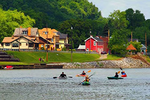
Ohio River
The Ohio River is formed by the confluence of the Allegheny and Monongahela Rivers at Point State Park in Pittsburgh, Pennsylvania. It ends 981 miles downstream in Cairo, Illinois, where it flows into the Mississippi River. At this convergence, the Ohio is larger than the Mississippi. The Ohio River supplies drinking water and provides recreational uses for over five million people. The water quality and ecology of the Ohio River has been influenced in the last one hundred years by industrial expansion, dam building, sand and gravel dredging, coal mining and steel manufacturing. Just 50 years ago, the Ohio River ran red with unregulated pollution and was quite inhospitable to aquatic life, which decimated fish populations. The Ohio River has experienced a rebirth and now represents one of the most diverse freshwater ecosystems on earth. The Ohio River Trail Council, Friends of the Riverfront, and RiverWise collaborate in planning, education, and community revitalization initiatives along the riverfront.
Voting has ended. Check back soon for updates.
For more information contact Angela Vitkoski at avitkoski@pecpa.org.